Hurricane Michael reaches Category 2, threatens southern US
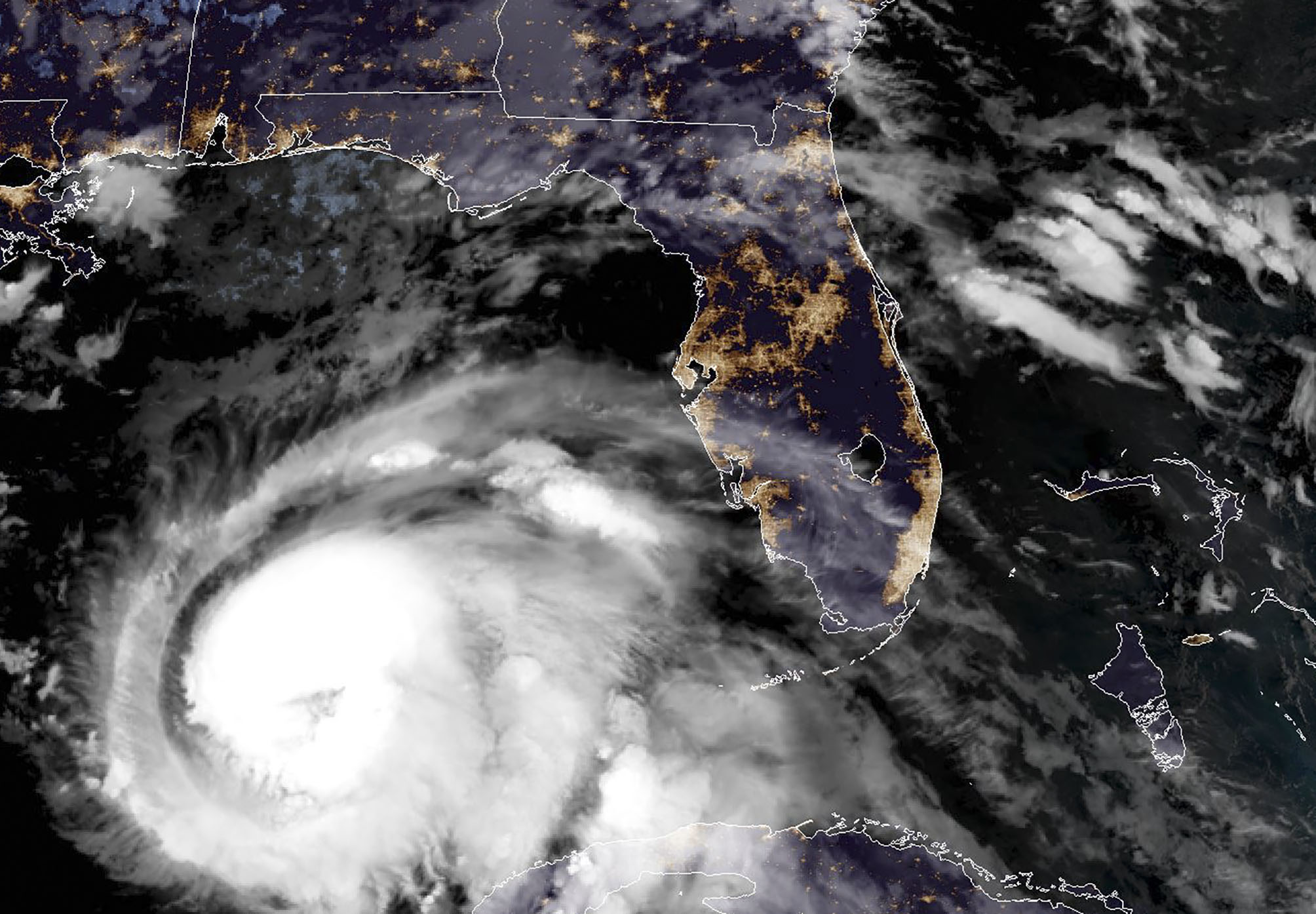
This NOAA/RAMMB satellite image taken on October 9, 2018 at 11:45 UTC shows Hurricane Michael off the US Gulf Coast (Lizabeth MENZIES)
Miami (AFP) – Hurricane Michael strengthened to a Category 2 storm with winds over 100 miles per hour on Tuesday as Florida’s governor warned it could bring “total devastation” to parts of the southern US state.
The storm — currently located over the Gulf of Mexico — is sweeping toward the Florida coast at around 12 miles (19 kilometers) per hour and is expected to make landfall on Wednesday afternoon, bringing with it “life threatening” storm surges and heavy rainfall, the National Hurricane Center said.
“It is a monstrous storm and the forecast (keeps) getting more dangerous,” said Florida Governor Rick Scott, who has activated 2,500 members of the National Guard in response. “The time to prepare is now.”
It “poses a deadly threat and as it grows stronger, we can expect it to make landfall as a major Category 3 storm,” said Scott, warning that it “could bring total devastation to parts of our state, especially in the panhandle.”
A hurricane warning was up across the Florida panhandle, a low-lying area of beachfront resorts and retirement communities on the northeastern Gulf coast, and a state of emergency has been declared in 35 of the state’s counties.
A mandatory evacuation for Bay County, located in the panhandle, affects some 120,000 residents, Sheriff Tommy Ford said.
Forecasters warned of coastal flooding, with storm surge and tides projected to raise water levels by as much as eight to 12 feet (2.5 to 3.5 meters) in some areas.
Rainfall of four to eight inches (10 to 20 centimeters), and as much as a foot in isolated areas, “could lead to life-threatening flash floods,” according to the NHC, which also warned that the storm’s approach could spawn tornados in northwestern Florida.
– ‘A big one’ –
Michael was forecast to have the power to uproot trees, block roads and knock out power for days by the time it hits Florida. It is expected to weaken as it moves up into the southeastern United States.
Televised images showed long lines at gas stations and residents hurrying to fill sandbags, while tolls were suspended on some roads to aid movement ahead of the storm’s landfall.
“Since 6:00 am it’s been backed up, we’re just now running out of regular (gasoline),” Danny Hess, an employee at a gas station in Panama City, told local WJHG television.
President Donald Trump said Tuesday that he has been in contact with officials about the incoming storm — which he termed “a big one” — and that the government, including the Federal Emergency Management Agency (FEMA), was ready.
“We are very well prepared. FEMA’s ready. We’re all ready. Spoke with Governor Scott, spoke to everybody that you have to speak to,” Trump told journalists at the White House.
The Carolinas are still recovering from Hurricane Florence, which left dozens dead and is estimated to have caused billions of dollars in damage last month.
It made landfall on the coast as a Category 1 hurricane on September 14 and drenched some parts of the state with 40 inches of rain.
Last year saw a string of catastrophic storms batter the western Atlantic — including Irma, Maria and Hurricane Harvey, which caused a record-equaling $125 billion in damage when it flooded the Houston metropolitan area.
Scientists have long warned that global warming will make cyclones more destructive, and some say the evidence for this may already be visible.
At their most fearsome, these low-pressure weather fronts pack more power than the energy released by the atomic bomb that levelled Hiroshima.
Disclaimer: This story has not been edited by Siliconeer and is published from a syndicated feed. Siliconeer does not assume any liability for the above story. Validity of the above story is for 7 Days from original date of publishing. Content copyright AFP.


