Prospecting the Underwater Wealth: India to Harness the Mineral-rich Indian Ocean Bed
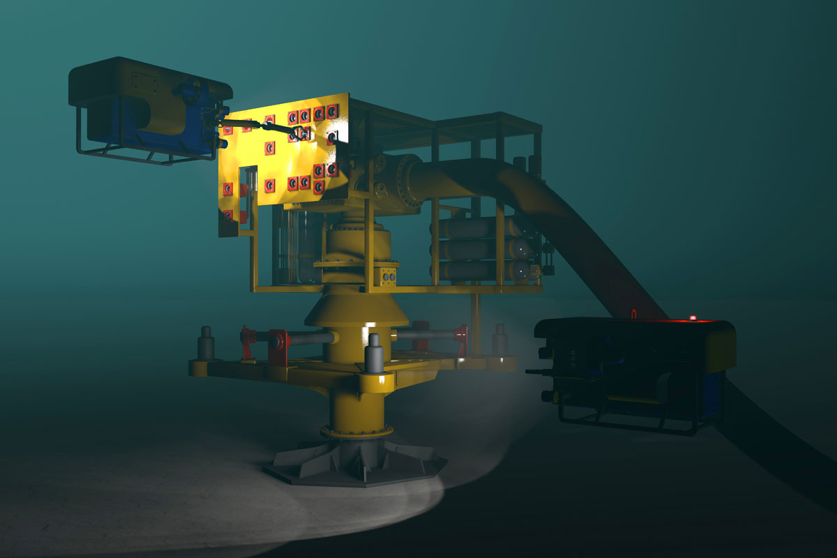
A 3D render of a ROV adjusting underwater oil and gas equipment.
Bound on three sides by the gigantic and mysterious Indian Ocean, India is set to reap a sea of dividends as the Geological Survey of India accelerates its ambitious project of exploration of mineral-rich crusts of deep sea beds to a depth of about 30 meters employing a Singapore-made special geo-technical vessel with drilling capabilities, writes Priyanka Bhardwaj.
Geological Survey of India director general M. Raju informs that though no consolidated report exists on the true amount of mineral wealth at present, studies suggest an immense potential.
The induction of the special geo-technical vessel in the coming two years will augment the existing fleet of three vessels, and enable GSI to collect samples instead of relying on grab samples procured by non-drilling ships, negotiate the actual dimensions of the sea bed, as well as estimate the accurate depth of mineral resources from it.
Seabed mapping which involves profiling, sampling at regular intervals and scanning of sea bed within and beyond territorial waters was initiated in 1965.
Then in 2014 “High Resolution Seabed Mapping and Natural Resource Evaluation” was made a mandate of the three vessels; Samudra Ratnakar, Samudra Kaustabh and Samudra Saudikama – that identified marine resources off Mangaluru, Chennai, Mannar Basin, Andaman and Nicobar Islands and around Lakshadweep Islands.
Samudra Ratnakar, the most sophisticated of the trio, has a high end scientific instrument that facilitates focused offshore exploration cruises, and execution and delineation of potential mineral zones.
Ashish Nath, superintendent geologist at GSI states that, “The main objectives have been to identify potential zones of favorable mineralization, and evaluate marine mineral resources such as lime mud, phosphorite, calcareous sediments, hydrocarbons, metalliferous deposits and micronodules.
Till date the GSI has generated 181,025 square kilometers of high-resolution seabed morphological data and target zones include the sea beds in Arabian Sea, Bay of Bengal and Andaman Sea.
Among the discoveries have been gas hydrates in sub-surface layers of Mannar basin, and 10,000 million tons of lime mud spread over an area of 4300 sq. km off the Gujarat coast.
The step up in the exploratory regime will be crucial to establish the commercial viability of mineral deposits and also precious metals such as gold and silver in the southern Indian Ocean.
The first ever seabed exploration for polymetallic sulphide (a mineral deposit with three or more metals such as copper, iron and lead primarily and also gold and silver in lesser amounts) is being conducted in the Rodriguez Triple Junction (RTJ), a geological junction or meeting point of three tectonic plates meet near Mauritius, in the Southern region of the Ocean, license for which was received in September 2016 from the International Seabed Authority, an autonomous international organization formed under the aegis of the 1982 United Nations Convention on the Law of the Sea.

The International Seabed Authority contract to India for exploration of polymetallic nodules that yield rare earth minerals used in smart phones, hybrid cars, steel and cameras will end in 2017 after which mining can be commenced.
Other benefits accruing from such an immense high resolution topographic mapping and multichannel seismic survey is geostrategic and defense preparedness, and study of chemosynthetic bacteria that form the base of the food chain.
The GSI has brought on board other government bodies, the National Center for Antarctic and Ocean Research (NCAOR) and National Institute of Ocean Technology (NIOT) based at Goa for the deep seabed exploration.
Shailesh Nayak, earth sciences secretary, states that the exploratory budget is pegged at Rs. 100 billion and the regime is open to incorporation of foreign participation for their advanced technology for eventual extraction of metals.
The second stage will comprise GSI, NIOT and NCAOR operating a remotely operated vehicle (ROV) to identify both active and inactive hydrothermal vents or fissures on the seabed surface that lie close to active volcanic and tectonically prone regions with the possibility of black smokers or hydrothermal vents spewing particle laden fluids at very high temperature of 350° to 375° Celsius along with a variety of minerals.
The goal is to reach inactive vents that will have mineral deposits around them and are likely to be situated a few kilometers away from active ones.
Though human exploration of oceans for huge amounts of previously untapped resources is an endeavor since the 1860s, only 5% of the deep-sea floor that covers about 60% of the earth’s surface has ever been explored.
Mining was however a late affair, beginning only in 1960s, yet with the discovery of vast repositories of minerals in developing countries and crash in prices, the fascination with the ocean-sourced minerals waned.
Again, with burgeoning demand, dwindling of reserves in most nations and skyrocketing prices, especially with China monopolizing the entire trade by virtue of its production of more than 90% of total mined minerals, developed countries have resolved to look into sovereign and international waters that are believed to hold more than 20-30% of requite minerals mined in China and thus rework strategic relations around exploration of sea beds.
With the revival of underwater exploration, the ISA, since 2001, has approved 27 contracts, each for a period of 15 years, to dig into the “common heritage of mankind” in an area measuring approximately 1.2 million square kilometers of sea bed— a third the size of India.
While 20 sponsor countries including China and Russia have 4 licenses each – the UK, France, Germany, India and Japan have two each.
Of the private mining firms UK Seabed Resources, an English subsidiary of the US defense giant Lockheed Martin, is the recipient of exploration rights to an area larger than the entire UK.
As human understanding of the once inaccessible oceans and advanced knowhow to explore progresses, the race to license areas of the deep ocean is expected to intensify.
Already China, Republic of Korea, and Germany have upped their exploratory ante in the Indian Ocean.
Exploration is followed by exploitation by way of mining, all of which is administered by the ISA and the UN acts as the chief regulator and ensures no exploitation of the ocean floor beyond 370-kilometer territorial limits to prevent a free-for-all.
Though there are cheers for securing underwater riches, scientists and environmentalists have sounded alerts on the dangers of disturbing the carbon sink and the sources of food if the ocean ecosystem is disturbed beyond a point, and of which there is utter lack of knowledge.
Already the oceans are facing the conflicts of development, and environment and technological exploitation is bound to introduce contamination, light in the deep dark spaces, noise, air pollution, vibration, turbidity, invasion of species, and also due to fluid leaks and discharges from vessels and equipment, all of which will wreak havoc in marine habitats and extinction or rare species that developed over millions or even billions of decades, and without which the sea beds are expected to lose minerals for eternity.
An example of this was the destruction of North American habitats due to overfishing of cod in 1980s and lack of recovery despite the closure of fishing since 1992.
As the deep seas have been identified as the next frontier of scientific and industrial enterprise, only a foolproof compliance to stringent international rules and laws can ensure safer exploitation and mining.


