How forecasters track Hurricane Dorian
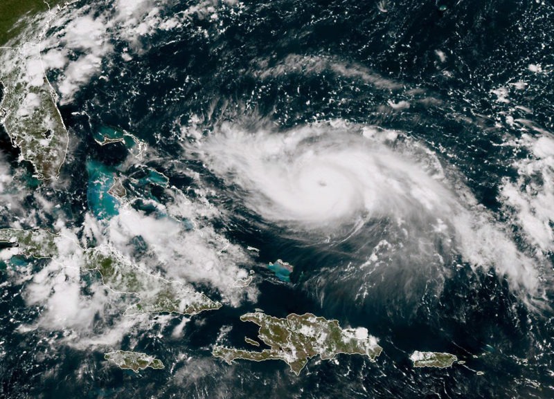
A satellite image shows Hurricane Dorian approaching the Bahamas and Florida on August 30 (HO)
Washington (AFP) – The path of Hurricane Dorian, which is currently over the Atlantic and heading for the state of Florida, is closely monitored by US weather services with powerful forecasting tools.
– Planes and satellites –
The priority is to collect as much information as possible about the hurricane itself, which is mainly done by sending planes into the storm — rough missions flown by specialized pilots.
On Friday, for example, seven flights by the National Oceanic and Atmospheric Administration (NOAA) and the US Air Force with aircraft known as “hurricane hunters” were planned in and around Dorian.
They record temperature, humidity, atmospheric pressure and wind speeds, and also drop probes that take measurements down to the surface of the ocean. Buoys and weather balloons can also be scattered before and during the hurricane.
Such field data is supplemented by information from above that is gathered via satellites and NASA.
The US space agency has a number of satellites oriented toward the earth. One of them, Suomi NPP, has its instruments focused on Dorian and gives information on its structure and strength, the temperature at the top of the clouds and the volume of rain.
– Models and forecasts –
This mass of data is then made available to all global weather services, feeding hundreds of forecasting models.
The European model, developed by the European Centre for Medium-Range Weather Forecasts, is recognized as the most accurate.
In Miami, a team of 10 forecasters from the National Hurricane Center (NHC) produce detailed forecasts predicting the path and intensity of emerging storms.
At any given moment, two of these forecasters are on duty, working eight-hour shifts. They produce their own predictions based on what the various models they use indicate.
“You need to know what’s going on all over the world in order to forecast,” because what happens in the Atlantic depends on weather elsewhere, said Sim Aberson, a meteorologist at NOAA’s Atlantic Oceanographic and Meteorological Lab.
– How precise? –
On the trajectory of a storm, which is the number one priority, forecasts have improved significantly since the 1970s.
“The expected forecast accuracy for a hurricane three days from now, right now is about the same as it was for a one and a half day forecast just about 10 to 15 years ago,” said Aberson.
But models have made less progress when it comes to hurricane intensity, which is classified on a five-level scale.
On average, the error at three days was about a category, or 25 kilometers per hour (15 miles per hour) of wind speed, according to Aberson.
It is for this reason that the NHC publishes probabilities — for example, 55 percent risk that West Palm Beach will be hit by winds exceeding 118 kilometers per hour (74 miles per hour) — and a cone of uncertainty illustrating the possible course of the storm.
The animations seen on television channels come directly from the forecasts of the team of 10 experts in Miami.
Disclaimer: Validity of the above story is for 7 Days from original date of publishing. Source: AFP.


